About
Duration: 1 hr 20 min (4.7 km)
Difficulty level: Easy
Season: May–Oct
A popular hike that is easily accessible for most people. The trail leads through forest terrain and heath – a great place to pick bilberries in the autumn!
Description of hike
The hike starts on the opposite side of Solvika Cafe, on Skisjøvegen. You pass a barrier, continue approx. 100 m and follow the footpath towards Fiskebekkåsen to the right. The footpath is waymarked but be aware that it’s easy to lose going uphill. The hike takes you through fine forest terrain with heath and marshy ground, and crosses Gamlevegen, which is an old road between Skien and Siljan.
If you prefer a shorter hike, you can turn left to come back out on Skisjøvegen and follow the road back to Solvika Cafe. Once you’ve crossed the...Read More
About
Duration: 1 hr 20 min (4.7 km)
Difficulty level: Easy
Season: May–Oct
A popular hike that is easily accessible for most people. The trail leads through forest terrain and heath – a great place to pick bilberries in the autumn!
Description of hike
The hike starts on the opposite side of Solvika Cafe, on Skisjøvegen. You pass a barrier, continue approx. 100 m and follow the footpath towards Fiskebekkåsen to the right. The footpath is waymarked but be aware that it’s easy to lose going uphill. The hike takes you through fine forest terrain with heath and marshy ground, and crosses Gamlevegen, which is an old road between Skien and Siljan.
If you prefer a shorter hike, you can turn left to come back out on Skisjøvegen and follow the road back to Solvika Cafe. Once you’ve crossed the road, follow the footpath to the illuminated ski trail, which then turns left to return to the ski arena. Follow the waymarked footpath before the ski arena. The footpath returns to Gamlevegen, following it a few metres to the right, and then turns left towards Solvika, coming back out on the road by the barrier.
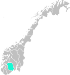
Map hiking route
Access
To get to Solvika Cafe on county road 32, turn left towards the slalom hill and sign “P 100 m”. 100 m along you’ll find a parking area on the left-hand side. You can also start from the car park at the ski arena by the water tower. To get there, drive towards Siljan and turn on to Industrivegen at the sign “Lysløype” [illuminated ski trail]. Continue to the end of the road. You can also take the Grenlandsekspressen express bus or local bus P7 to the Heivannet/Solvika Cafe bus stop.
Read Less

 to add an item to your Itinerary basket.


 Walking areas in Siljan, SiljanIn Siljan you have access to light trails, ski trails, nature trails, bike routes as well as fishing opportunities in more than 80 lakes and many bathing spots.