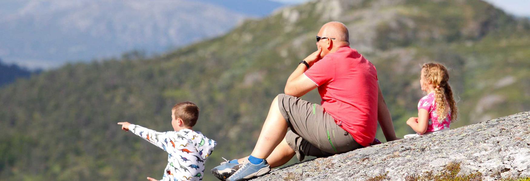
Explore Telemark
Telemark Mountain

To build your own Itinerary, click  to add an item to your Itinerary basket.
Already saved an Itinerary?


All hiking trails in HikingTelemark are well signposted, marked and graded in four different colors according to level of difficulty. Well marked trails makes it easy and safe to navigate. Here´s a brief introduction to the Norwegian grading system, to help you find the trip that best suits you and your tour mates:

The system consists of four color coded icons: green is easiest, blue is medium, red is challenging, and black is expert.
How demanding a trail is, is partly determined by the number of meters ascent and the length of the trip. The purpose of grading the trails is to create security and well-being among hikers.
Number of results: 34
, currently showing 1 to 20.
A hiking trail with two loops: one with views, old homestead sites, and burial mounds, and the other with blueberries, animal tracks, and historical finds.
Treungen
| medium |
|---|
| 2 hours |
|---|
| length in km | 5 km |
|---|
| beach | |
|---|---|
| cultural landscape |
Experience breathtaking views over Fyresdal from Igletjønnuten, with historic traces from the Middle Ages, including deserted farms and medieval ruins.
Fyresdal
| challenging |
|---|
| 5 hours |
|---|
| length in km | 10.3 km |
|---|
| geological finds | |
|---|---|
| mountain |
A walk through beautiful landscape and Smorklepp Art Museum - Sorensen and Kihle. This is an easy walk in part of the Vinje cultural landscape.
Vinje
| medium |
|---|
| 2 hours |
|---|
| length in km | 4 km |
|---|
| forest | |
|---|---|
| waterfall |
This is a great hike to the mountain top, Skuggenatten in Treungen.
Treungen
| challenging |
|---|
| 3 hours |
|---|
| length in km | 4.3 km |
|---|
| mountainous terrain | |
|---|---|
| view |
Take the boat to Norway’s highest church and walk along Kvennevassdraget on Hardanger Mountain Plateau. A 1.9 km round trip on Møsstrond in Vinje. A light walk through a pedestrian village.
Rauland
| easy |
|---|
| 1 hour |
|---|
| length in km | 1.9 km |
|---|
| national park | |
|---|---|
| gravel |
THIS IS AN EASY TRIP
for all the family through a beautiful
landscape full of culture and history.
Tuddal
| easy |
|---|
| 2 hours |
|---|
| length in km | 5.4 km |
|---|
| water | |
|---|---|
| gravel |
Tougher hike than Gaustatoppen. However, you will get a great view towards Gaustatoppen and Tuddal.The trip is about 3 km and takes about 2 hours each way
Rjukan
| challenging |
|---|
| 2 hours |
|---|
| mountain | |
|---|---|
| hilly | |
| lookout point | |
| stony | |
| small path |
Hike the Saboteur's Trail from Rjukan Fjellstue to Vemork and experience WWII history, following in the footsteps of Norway's brave resistance fighters.
Rjukan
| medium |
|---|
| 3 hours |
|---|
| length in km | 8 km |
|---|
| hilly | |
|---|---|
| cultural landscape |
Round trip from Dalen where you cross the river Tokkeåi via the suspension bridge over Helveteshylen (Hell)
Dalen
| medium |
|---|
| 3 hours |
|---|
| length in km | 9 km |
|---|
| forest | |
|---|---|
| river |
Take a peak trip to Fyresdal's 2. highest mountain, Roan. At the top you will be rewarded with a magnificent panoramic view over the mountains in Telemark.
Fyresdal
| challenging |
|---|
| 5 hours |
|---|
| length in km | 10 km |
|---|
| mountainous terrain | |
|---|---|
| view |
This is a great, family-friendly summit trip! Mount Venelifjellet – literally “the beautiful mountain” – is a popular hiking destination.
Vrådal
| medium | |
|---|---|
| challenging |
| 2 hours |
|---|
| length in km | 4 km |
|---|
| forest area | |
|---|---|
| view | |
| mountain |
Discover Hægefjell! A scenic, day hike with panoramic views over Vrådal and lake Nisser. Follow a well-marked trail in stunning terrain.
Kviteseid
| challenging |
|---|
| 6 hours |
|---|
| length in km | 12 km |
|---|
| mountain | |
|---|---|
| high mountain plateau |
Lådalstigen is a fantastic hike between Dalen and Lårdal. A large part of the hike follows the mountain ridge 800 metres above the Telemark Canal.
Dalen
| challenging | |
|---|---|
| expert |
| 8 hours |
|---|
| length in km | 14 km |
|---|
| mountain | |
|---|---|
| steep |
Hamaren is a walking trail by Lake Fyresvatn that is universally designed and suitable for pedestrians, cyclists, prams and wheelchairs.
Fyresdal
| easy |
|---|
| length in km | 3,5 km |
|---|
| asphalt | |
|---|---|
| gravel |
Tretopper’n (The Three Toppers) - the perfect family trip! Three small mountain peaks surround Jønnbu: Anebunatten, Krintofjellet and Bøkstulnatten, which together form a great round trip. The peaks are easily accessible and the trip between them…
Bø i Telemark
| medium |
|---|
| 2 hours |
|---|
| length in km | 5.5 km round trip |
|---|
| mountainous terrain | |
|---|---|
| view |
At Bjørgefjell you can choose from different paths through the cultural landscape with idyllic spots where you can enjoy panoramic views of Lake Seljordsvatnet.
Seljord
| medium | |
|---|---|
| challenging |
| 3 hours |
|---|
| length in km | 10 km |
|---|
| forest | |
|---|---|
| mountain |
The whole trip takes just under one hour at a leisurely pace. The tour is suitable for both families with children and elderly people. Most of the trail is suitable for wheelchair users.
Fyresdal
| easy |
|---|
| 1 hour |
|---|
| length in km | 3 km |
|---|
| asphalt | |
|---|---|
| gravel |
Skorve is one of the highest mountains in Seljord, with two peaks: Mount Gøysen and Mount Nordnibba. During WWII two planes crashed into the mountain.
Seljord
| expert |
|---|
| 5 hours | |
|---|---|
| 8 hours |
| length in km | 10 (14) km |
|---|
| mountain | |
|---|---|
| steep |
Experience a historic hike on the sherpa staircase from Dalen to Rui: 1 km, 810 steps, and 200 meters of elevation in about 20-30 minutes.
Dalen
| challenging |
|---|
| 4 hours |
|---|
| length in km | 5.5 km |
|---|
| steep | |
|---|---|
| cultural landscape |
A GREAT HIKE FOR THOSE WHO ARE light on their feet – the mountainside is steep.
Nissedal
| challenging |
|---|
| 4 hours |
|---|
| length in km | 11 km |
|---|
| mountain | |
|---|---|
| high mountain plateau |
Ratings & Reviews
Powered By
![]()


© Visit Telemark 2025. Copyright