Kvennavegen
Type:Hiking
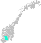
3864, Rauland


To build your own Itinerary, click  to add an item to your Itinerary basket.
Already saved an Itinerary?


km
1.9 kmA light walk through a pedestrian village
This is a light walk on pram-friendly gravel and plank roads to the eroded rocks and bathing place by River Kvenna. Great views over the mountain farm Argehovd in the foothills of the Hardangervidda plateau. Learn about life at Møsstrond through the years from the information boards along the way. Listen to the "talking post" to learn about life here today.
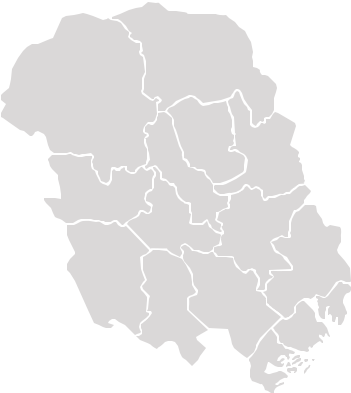
The highest lying mountain village in Norway
Around 150 people live in Møsstrond, one of the highest lying mountain villages in the country. Around 40 of them have no road access, and many are livestock farmers. The motor road ends at Varland, where the "waterway" across Lake Møsvatn begins. From here it is 30 km to the most remote farm. The lack of a road means that many people in Møsstrond make a living from offering boat and snowmobile transport as well as from tourism, hunting, fishing and farming. For those without a road the lake serves as a road all year round, whether it is clear or frozen over.
Starting point
Start the trip at the Mogen Turisthytte (cabin) and follow the village road towards Argehovd. After the bridge at Hellegjuvbekken take a left along the dirt road that runs parallel to the stream. After about 100 m turn right and follow the path towards Kvenna. From there follow the rocks along the river before turning right and crossing the marsh using the plank road, ending up on the village road. Follow the village road back to Mogen.
Raulandsakademiet is a course center, a hostel and a rural museum.
A collection of replicas of local traditional log buildings, filled with cultural…
The museum shows sculptures, paintings, graphic art and drawings by the famous artist…
The Skinnarland Collection houses more than 100 works of art by sculptor Knut Skinnarland…
At the Norwegian Industrial Workers Museum at Vemork you can see the unique exhibition…
The valley of Smørklepp in Vinje made a lasting impression on the famous Norwegian artist…
The sun mirrors bring sun down to Rjukan Square during winter months, when it is normally…
Vieving stones.
Eight different sculptured "vieving stones" have been placed in to the…
The mountain Gaustatoppen in Rjukan in Telemark county is easily accessable and one of…
For about 1000 years Tokke has had an export industry of whetstones. For Norwegian…
To experience the rich cultural heritage and traditions of Western Telemark, the museum…
Charming, small stave church. Located by West Telemark Museum in Eidsborg.
Ratings & Reviews
Powered By
![]()


© Visit Telemark 2025. Copyright
